


Events Calendar
vizite
Relief
It stated, rightly, that Subcarpaţii is the most original part of the Romanian Carpathians (De Martonne, 1931) that are not repeated in any other European mountain chain similar shapes. Despite their record to the geographical landscape of the country, Subcarpaţii were not differentiated as a separate area until the last decade of the nineteenth century, before being considered as part of the mountains. Today, Subcarpaţii is a complementary area of the mountains that undoubtedly has some aspects that make the transition to relief through hilly lands belonging to another geographical categories.
In the area of Prahova and Dambovita, Subcarpaţii regains Subcarpaţii extension of the curvature lines have anticline east-west orientation corresponding to peaks and the synclines, partitions, elongated depressions. The specific feature of this sector gives geological belt of heights belonging flysch, that start east of Prahova Valley and go up to Dambovita Valley. That is the height N. Popp (1939) called it "anticline marginal" by ending the South "Carpatho-Carpathian zone interference" (in the springs Cricovului). Just south of "marginal anticline" start own Subcarpaţii -zişi; with mio-Pliocene their composition, uplifted through such recent sharp in places, up to diapirism.
What should be pointed out is the tectonic very recent (such Wallachian products at the end of the Pliocene and early Quaternary) which revealed the inner structure strong inclination layers until diapirism, and at the outer edge of an area of subsistence dive compensating to rise and searching Subcarpathians.
What strikes first is adaptation tectonic relief structure. This is typical to the external area. Here heights (hills) correspond with anticlines and synclines valleys with. Some peaks are those typical character corresponding anticline tectonic Moreni - Gura Ocniţei. Given the fact that to Sub-Carpathian they are affected by tectonic movements and deposits Levantine, that relief is very young.
Subcarpathians external mioeliocene formed from deposits, less harsh forms a lowered level of this unit of relief.
The presence of rocks slightly loose (sand, gravel, marl, clay) favored erosion and as a result of transport heavy materials on the slopes have formed a number of outfalls and broad valleys, meadows well developed as meet Cricov Long Valley downstream. Depression filled landscape and by numerous landslides which old or present (last in 1980) out of economic circulation considerable area of agricultural land even destroying homes (6 in 1979).
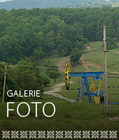
Subcarpathians external, are formed mostly in myo-Pliocene formations bearing oil and gas and crossed by a series of diapirs are present massive salt. To exploit these riches, natural forests were partially cleared, so the torrential bodies have developed greatly and accelerating the phenomenon of land degradation.
In this region the highest peaks reach 500-600 m. The anticline Gura Ocniţei - Moreni is the last accident tectonic visible of external Subcarpathians. The greatest heights are in the northern part of the village, on the lower Pliocene formations or helveţiene, and the lowest (less than 500 m) to the southern part, the formations levantiene.
In the southern part is obvious area "piedmont plain of Cricovului Dulce" (GH. Niculescu -1960) known as the "Plain Măgurei" (V. Mihailescu - 1966) or "Pintenul Măgurii" (G. Vîlsan - 1915) that distinguished from neighboring areas, not only of altitude, but also by physical and geographical peculiarities. Genetically speaking part of the hilly piedmonts. Slightly mentioned in attempts monographic about the town Moreni this "plain" is evident in the extreme southern part of the village, due to unevenness of 100-150 m. To Subcarpathians where descends gently sloping from 320 m. As has Moreni 160 m. to south of the county.
From geological point of view, this area in the south of the village is composed of quaternary deposits that sit on a foundation of clay, sand and gravel Levantine. Fragmentation relief is given by tributaries of the river and creek Pascov Cricov separated by water from the hill turn Tuicani - Pietris. Lithological nature of the plain does not allow for groundwater horizons that can be used. In addition, the existence of small valleys, narrow fragment powerful this area, forest, explains why residents receive Morenii sat on hills and not in this valley "the high plain".
Hills most popular are: "Viişorul" on the east side of the village (the name indicates that it must have been meant in the past through vineyards) and "yearling" located between the valleys dobresti and fuel oil. Cricovului hill to the right is "face". In the western hills are the most important "Pleaşa" "Mara" and "Cristian". Peak district is above Lupoaia "Tisa" Tuicani ravine once famous for its plum orchards is based walking Ash lazy brook. Pacurile creek runs through the hill of the same name and on the hill Sângeriş collect their water during heavy rainfall creek of the same name.
Located in the hilly area of contact between the north and south piedmont plain area, city administrative territory Moreni includes various geomorphological forms with rich physical phenomena - geological modeling of the land.
As a result of the action of erosion, transport and sedimentation of the river and river network Cricov secondary geomorphological forms revealed the following:
• hilly area occupying mostly the territory, which acted on a number of climatic and hydrographic factors, shaping it into microforms relief.
• steep slopes area develops at the contact between the medium and spur Măgurii terrace.
• high terrace appears as patches and specifies only lithology of the area of the upper terrace.
• upper terrace, develops south of the hill Magura contact with Bana and hilly area - Piedmont Plain and in the west form plateau Tuicani
• Average connection terrace area - hilly peaks.
• terrace average low altitudes occupy the depression created by valley Cricov, developing parallel but with some interruptions in areas where the hills come in direct contact with the floodplain.
• lower terrace of the river Cricov develops a side of the river width of 200-800 m. in on the right side of it. -
delimits the floodplain of the river during the day Cricov thereof having an extension in width 30-100 m., maximum width occurring downstream.
Moreni city develops in the southern hilly area of Carpathian hills to the high plain, piedmont - Spur Magura.
Moreni city belongs to the geomorphological area Carpathian foothills, an area characterized by the appearance of all forms of relief with the city's development especially in the patio area and less in the connection with its hilly peaks.
Geologically, the town Moreni internal Foredeep fall of the Eastern Carpathians, the perimeter of which was accumulated a thick blanket of sedimentary deposits miopliocene subject wrinkling stress and fracturing under the influence of orogenic movements.
Tectonically, Moreni City area belongs diapirs exaggerated area, the city itself being located in the kernel salt diapir shaft anclinatului Gorgota - Moreni - Filipeşti.
City being located in an area with a rich underground deposits of hydrocarbons, stationed to geological formations of different ages, the otherwise maximum around salt diapir that has direction east - west, determined the maximum exploitation of these deposits.